What Is The Deepest Canyon In Mexico?
Sumidero Canyon in Chiapas has walls above 1,000 m, but Barranca de Urique in the Copper Canyon system is the widely cited deepest canyon in Mexico at about 1,870 m. Here is how the depth claims hold up and how to see Sumidero.
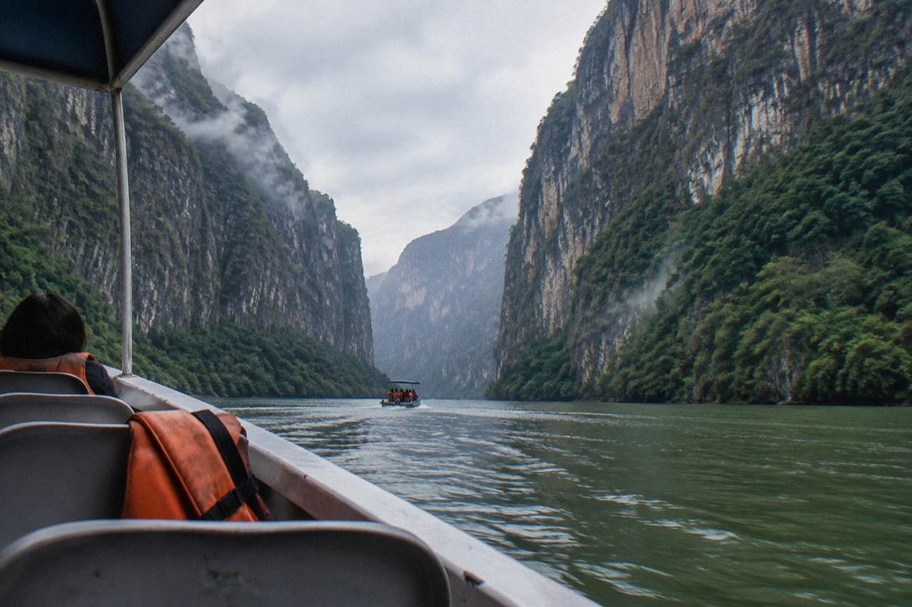
The deepest canyon in Mexico, by the measure most often cited, is Barranca de Urique, part of the Copper Canyon system in Chihuahua, at about 1,870 m. Sumidero Canyon in Chiapas, a limestone gorge on the Grijalva River, is shallower, with walls commonly cited at more than 1,000 m above the water, with one 2026 source giving about 1,200 m at the El Roblar viewpoint. Copper Canyon in Chihuahua is the larger and better-known canyon system, and many sources describe it as bigger overall.
That distinction matters more than it sounds. People searching for the deepest canyon in Mexico are usually standing at the start of a Chiapas trip, and Sumidero is the one you can see in a single morning from a boat. Copper Canyon is a multi-day rail journey in the far north. The two are not competing for the same traveler, and either can be the right choice.
The title most often goes to Sumidero Canyon in Chiapas, a national park since 8 December 1980 covering 21,789.41 hectares, where limestone walls are commonly cited at more than 1,000 m above the Grijalva River. One 2026 source gives about 1,200 m at the El Roblar viewpoint. No official ranking of Mexican canyon depths exists, so every claim rests on commonly cited figures.
The decree and the area figure are the firmest numbers in the whole debate. The park, officially Parque Nacional Cañón del Sumidero, was decreed on 8 December 1980 and its current area is listed at 21,789.41 hectares by the National Commission of Natural Protected Areas, whose park record is public on the CONANP park information system. That is the closest thing this question has to an official anchor: a protected area with boundaries, a decree date and an administering body.
The depth figures are softer. Sources across tourism guides and reference pages commonly cite walls above 1,000 m, with ranges running roughly 1,000 to 1,300 m depending on where and how you measure. One 2026 source puts the maximum at about 1,200 m specifically at El Roblar, one of the five public viewpoints on the miradores road above the canyon. The river depth is a separate claim entirely: figures of more than 250 m below the surface appear repeatedly, but they trace to older citations and should be read as a legacy figure rather than a fresh survey.
The geology explains why the walls cut so steeply. Sumidero formed along a tectonic fault, with the Grijalva eroding through limestone laid down as marine sediments in the Upper Mesozoic, roughly 80 to 136 million years ago. The dam at the northern end, the Presa Manuel Moreno Torres at Chicoasén, holds a reservoir over the final stretch, which is what keeps the navigable section boat-ready all year.
If the comparison you actually came for is Sumidero versus the Grand Canyon, the companion piece on canyon size against the Grand Canyon works through that matchup with the same ground rules.
How Deep Is Sumidero Canyon Really?
Sumidero's walls are commonly cited above 1,000 m, with about 1,200 m at El Roblar given in one 2026 source, and the river below is said to run more than 250 m deep, though that depth figure is an older, repeatedly recycled citation. The canyon is about 30 to 33 km long and 1 to 2 km wide, narrowing to roughly 200 m in places. Every figure here is commonly cited rather than officially measured.
Breaking the numbers apart helps. Wall height is the figure people mean when they call a canyon deep: the vertical distance from the water to the rim. For Sumidero that is commonly cited above 1,000 m, and the viewpoints along the Calzada al Sumidero from Tuxtla Gutiérrez, La Ceiba, La Coyota, El Roblar, Los Chiapa and El Tepehuaje, put you at the top of that drop. The canyon's width varies widely, from 1 to 2 km across in open stretches down to about 200 m where the walls pinch.
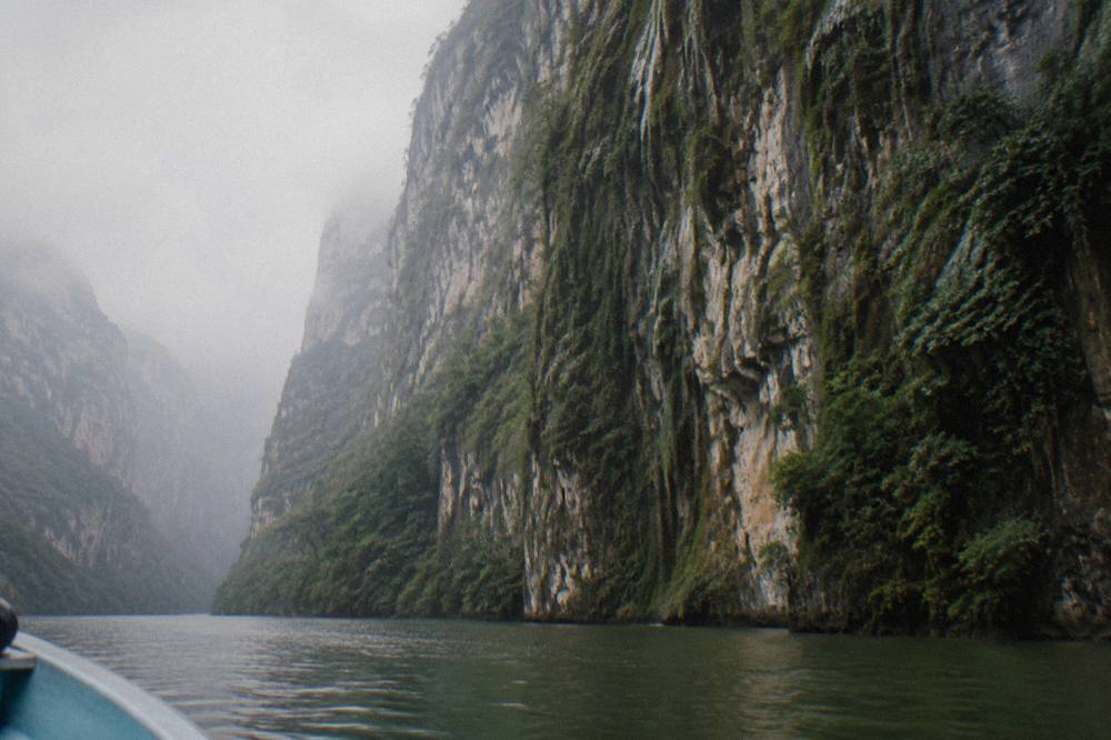
Then there is the water. The navigable section ends at the Chicoasén dam, which impounds the reservoir covering the northern canyon, and claims of river depth beyond 250 m circulate widely. Treat that one with care: it appears in older tourism literature and has been repeated without a modern bathymetric survey behind it. The canyon's own geology, a fault-line gorge through limestone, makes extreme depths plausible in the drowned section, but plausible is not measured.
One point that surprises many visitors: from the boat, the depth you feel is vertical and close. The listing for the Selva Azul Chiapas premium day from San Cristobal describes a 90-minute boat tour with a photo stop at a mirador on the drive down, so a single booked day can give you both perspectives, the rim looking down and the water looking up. That up-down contrast is the cheapest way to grasp what a 1,000 m wall actually means.
How Does Copper Canyon Compare?
Copper Canyon, the Barrancas del Cobre system in Chihuahua, is commonly described as larger than Sumidero and, in parts, deeper, and as a system it is a group of several gorges carved by different rivers. Within it, Barranca de Urique is the widely cited deepest canyon in Mexico at about 1,870 m. Sumidero is shallower, with walls of about 1,000 m or more above the river. Copper Canyon is the grander system, Sumidero is the more accessible single gorge.
On the numbers: Barranca de Urique, within the Copper Canyon system in Chihuahua, is the widely cited deepest canyon in Mexico at about 1,870 m. Sumidero is shallower, with walls of about 1,000 m or more above the river. Copper Canyon is the better-known Mexican canyon internationally, it is commonly cited as larger, and it is a system of multiple canyons rather than one gorge.
| Sumidero Canyon | Copper Canyon | |
|---|---|---|
| Location | Chiapas, southern Mexico | Chihuahua, northern Mexico |
| Type | Single limestone gorge on the Grijalva | System of several gorges (Barrancas del Cobre) |
| Depth figure | Walls commonly cited above 1,000 m | No confirmed figure |
| Typical way to see it | Two-hour boat ride plus rim viewpoints | Multi-day rail journey and hiking |
| Time needed | One day, often half a day on the water | Several days |
| Best base | Tuxtla Gutiérrez or San Cristobal | Creel, Divisadero or Los Mochis |
The practical difference is bigger than the geological one. Sumidero sits an hour's drive from San Cristobal and 15 to 30 minutes from Tuxtla Gutiérrez, and the shared boats leave the Chiapa de Corzo embarcadero daily, with park hours of 8:00 to 17:00 by water. Copper Canyon demands the famous railway and days of commitment. If the question behind your search is "which one can I actually do," Sumidero wins by a distance no canyon measurement contest will ever settle.
Why Depth Alone Is The Wrong Question
Depth is the headline number, but a poor basis for choosing a trip. A canyon viewed from a distant rim and a canyon ridden through at water level deliver completely different experiences at the same depth rating. Sumidero's real advantage is not a metric: the full height of the walls is visible from a boat in two hours, with wildlife, caves and seasonal waterfalls along the route, inside one bookable day from either city.
Consider what the boat actually passes. The route from Chiapa de Corzo runs up the Grijalva to the Chicoasén dam wall and back, about two hours round trip, and the named sights along it include the Belisario Domínguez bridge, Cueva de Colores with its shrine to the Virgen de Guadalupe, Cueva del Silencio, and the Árbol de Navidad and Velo de Novia waterfalls. In the rainy season, May to mid-October by the national weather service's definition, the Árbol de Navidad runs harder; in the dry months it can slow to a trickle over the moss formation that gives it its name. No operator can promise either state, and none should.
Wildlife is part of the same picture. Crocodiles, spider monkeys and birds including herons, cormorants, pelicans and vultures are reported along the ride, with no official population counts; what is on record is that Profepa released 13 rescued river crocodiles into the park in October 2026. The deeper guide to wildlife on the canyon ride covers what is actually reported and what nobody can promise.
This is where the depth question quietly becomes a booking question. The Jalapeño full day from San Cristobal, the most reviewed tour on this site at 4.6 from 268 reviews, from $85 per person, strings together the viewpoints drive, the canyon walk and Chiapa de Corzo in 8 to 9 hours. The budget OTISA day at from $46 per person covers the boat and the town in 9 hours with a Spanish-speaking service. Same canyon, same depth, very different days.
The Apasionado x Chiapas day from Tuxtla, rated 4.7 from 175 reviews, from $53 per person, is the strongest Tuxtla-side option among these tours for the same reason: it puts three hours into the canyon itself and still ends with drop-off options in either Tuxtla or San Cristobal. Depth from the water is the product; everything else is logistics around it.
What The Numbers Do And Do Not Say
Every Sumidero figure in circulation traces to commonly cited ranges, not a single official survey: about 30 to 33 km long, 1 to 2 km wide narrowing to about 200 m, walls above 1,000 m with about 1,200 m cited at El Roblar, and an older more-than-250 m river depth claim. The official record covers the park's decree, area and hours, not its vertical profile. Treat any Mexican canyon depth ranking as an approximation.
There is a useful lesson in how these numbers travel. The wall height range appears consistently across reference pages and 2025 to 2026 tourism guides, which is why the figure is commonly cited. The El Roblar 1,200 m figure is newer and more specific, which makes it more interesting and no more official: it comes from a 2026 source, not a government survey. The 250 m depth claim is the oldest of the lot and the one most worth labeling.
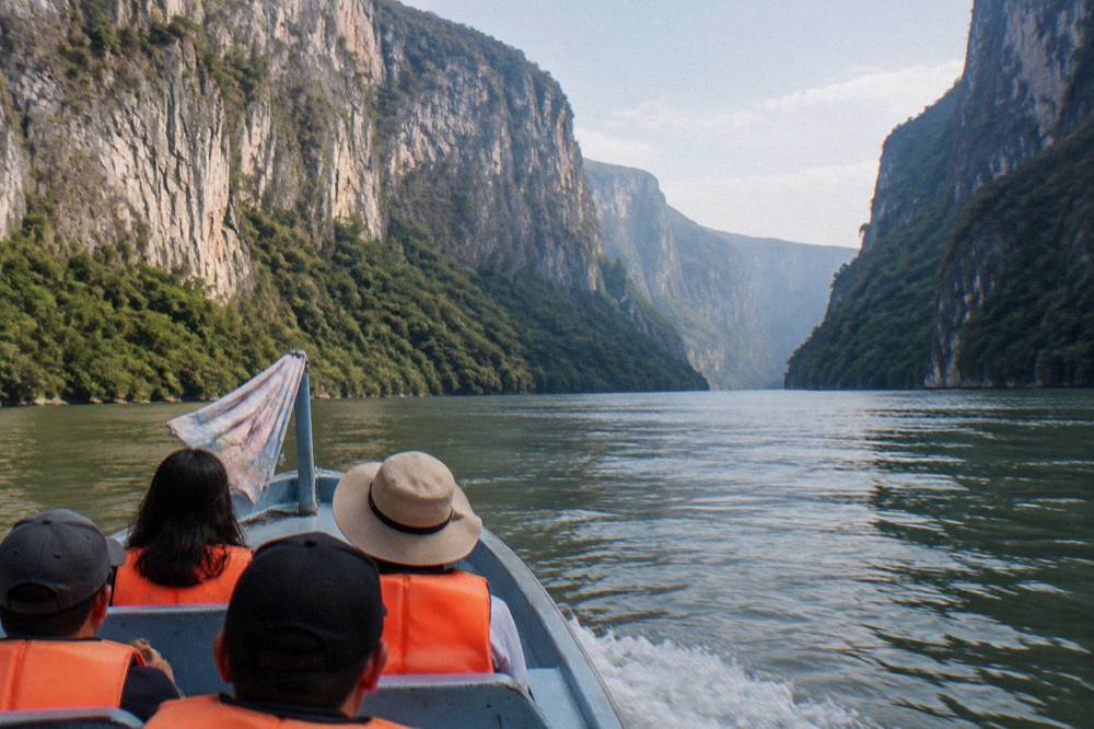
What is official, in contrast, is mundane and reliable. The park is open 8:00 to 17:00; water access runs every day; the miradores road is open Wednesday to Monday and closed Tuesdays, per the official CONANP park page. Entry costs 125 MXN per person per day, with exemptions for children under 12, older adults and people with disabilities, and discounts for students, teachers and Mexican nationals with credentials. The cooperative boat fare is separate: 460 MXN for foreign visitors, 400 MXN for Mexican nationals, 340 MXN for older adults with INAPAM credential and children, set by the boat cooperatives and changeable without notice. Most guided day tours on this site state the park fee is included, which is worth checking listing by listing before you book anything independent.
For planning around the seasons, the best time to visit guide covers the November to April dry window, when the river runs lower and clearer, against the May to mid-October rains that fill the seasonal waterfalls. The national weather service's 1991 to 2020 climate normals for the Tuxtla station show the shape of it: June, August and September each average more than 200 mm of rain per month, against 1 to 10 mm from November through March.
Seeing The Depth From The Water
The two-hour shared boat ride is the only way to stand, in effect, at the bottom of the depth figure, and it runs year-round from the Chiapa de Corzo embarcadero, daily park hours 8:00 to 17:00 by water. Life jackets are mandatory, drones are prohibited, and visitors must wear the conservation wristband. Guided days from San Cristobal or Tuxtla bundle the boat with transport, the viewpoints and time in Chiapa de Corzo.
Standing on a boat looking up at a wall commonly cited above 1,000 m is a different act from reading the number. The scale registers through detail: vegetation clinging to vertical limestone, caves stained by minerals, the river bend said to mirror the Chiapas coat of arms, and the dam wall that ends the run. Boats depart when full, and early departures are commonly recommended for light on the walls and calmer air.
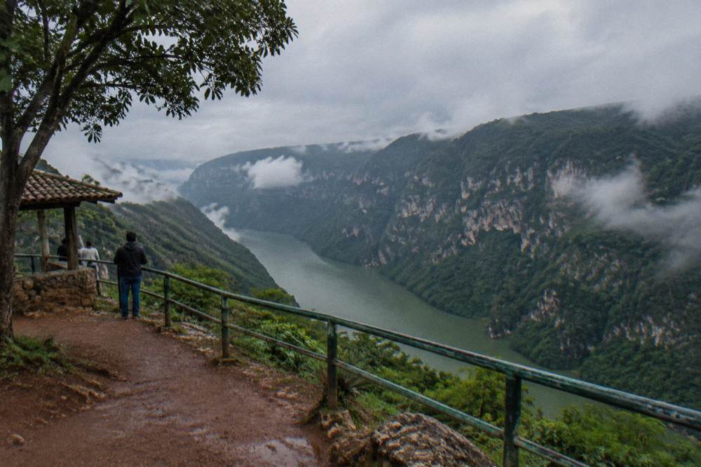
Then go up. The miradores road on the Tuxtla side gives the rim view, and the five viewpoints are reached by the Calzada al Sumidero. Remember the Tuesday closure before planning a viewpoints day, and remember that the same 125 MXN fee applies to land access, with the boat-day wristband valid the same day. A guided day that includes both, like the San Cristobal Canyon, Viewpoints & Chiapa de Corzo tour from Jalapeño, 8 to 9 hours, from $85 per person, rated 4.6 from 268 reviews, is the simplest way to buy the full vertical story in one transaction; its live listing states park and national park fees included.
For travelers starting in Tuxtla, the EcoExperiencias national park full-day from Tuxtla, from $83 per person, 7 hours, rated 3.9 from 36 reviews and capped at 10 travelers, lists hotel pickup and the park admission in its inclusions. The 5-hour Chiapas Family Tours day from Tuxtla, from $102 per person, rated 5 from 15 reviews, is the short bilingual option with hotel or bus terminal pickup. Sumidero Canyon Tours carries the full set of tours with each listing's inclusions stated line by line.
Which Trip Fits Which Traveler
Budget travelers have a $40 to $46 shared-day floor from San Cristobal, comfort seekers can take hotel-pickup days from $79 to $155 per person, and Tuxtla-based visitors have options from $48 to $102 per person. The depth is identical from every boat; what varies is group size, language, pickup and how many hours go into the canyon. Match the listing, not the canyon, to your trip.
| Listing | Operator | Price | Rating | Duration | Pickup |
|---|---|---|---|---|---|
| Budget boat day, viewpoints | Selva Azul | from $40 per person | 4 from 80 reviews | 8 hours | Transport listed, hotel pickup not stated |
| Budget fare, 9-hour day trip | OTISA VIAJES | from $46 per person | 4.6 from 104 reviews | 9 hours | Transport listed, hotel pickup not stated |
| National park full day, pickup | EcoExperiencias México | from $89 per person | 4.4 from 66 reviews | 9 hours | Hotel pickup listed, max 14 travelers |
| Premium boat tour | Selva Azul Chiapas | from $155 per person | 4.6 from 136 reviews | 8 hours | Hotel pickup listed |
The pattern across these tours is consistent: the cheap days are shared Spanish-language services with meeting points, and the premium days add hotel pickup, insurance and, in some listings, an English-speaking guide. The kayak option, a double-crossing experience from Tuxtla rated 5 from just 2 reviews, from $89 per person over 6 hours, exists for travelers who want the depth figure from water level under their own paddle. With a review pool of two, that rating describes two people's trips, no more.
Common Questions About The Deepest Canyon In Mexico
How Does Sumidero Compare With The Deepest Canyon In Mexico?
Barranca de Urique in the Copper Canyon system is the widely cited deepest canyon in Mexico at about 1,870 m, and Sumidero is shallower with walls of about 1,000 m or more above the river.
Is Sumidero Canyon Deeper Than Copper Canyon?
No. Barranca de Urique, in the Copper Canyon system, is the widely cited deepest canyon in Mexico at about 1,870 m. Sumidero is shallower, with walls of about 1,000 m or more above the river.
How Deep Is The River In Sumidero Canyon?
Figures of more than 250 m of depth below the surface circulate widely, but they trace to older citations rather than a modern survey, so treat them as a legacy figure. The reservoir held by the Chicoasén dam covers the northern section of the canyon year-round.
Can You See How Deep The Canyon Is From A Boat?
Yes. The two-hour shared boat ride from Chiapa de Corzo runs to the Chicoasén dam wall and back, passing below walls commonly cited above 1,000 m, with caves and seasonal waterfalls along the route. Most guided days from San Cristobal and Tuxtla include the boat plus the rim viewpoints.
How Long Is Sumidero Canyon?
Commonly cited at about 30 to 33 km for the navigable Grijalva section from the Chiapa de Corzo area to the Chicoasén dam, with widths from 1 to 2 km narrowing to roughly 200 m in places. The national park covering it was decreed on 8 December 1980 and spans 21,789.41 hectares.